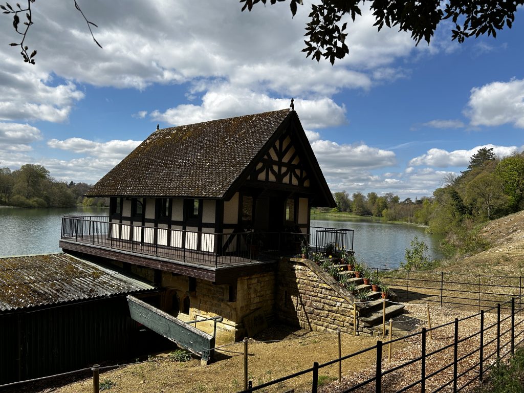
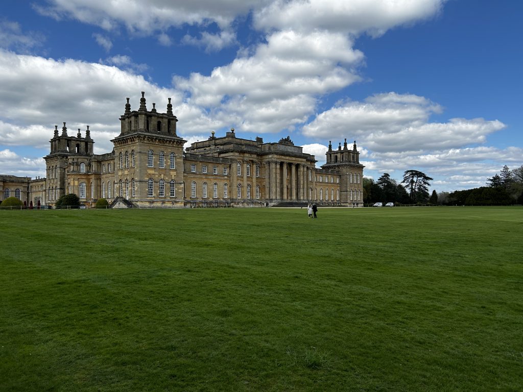
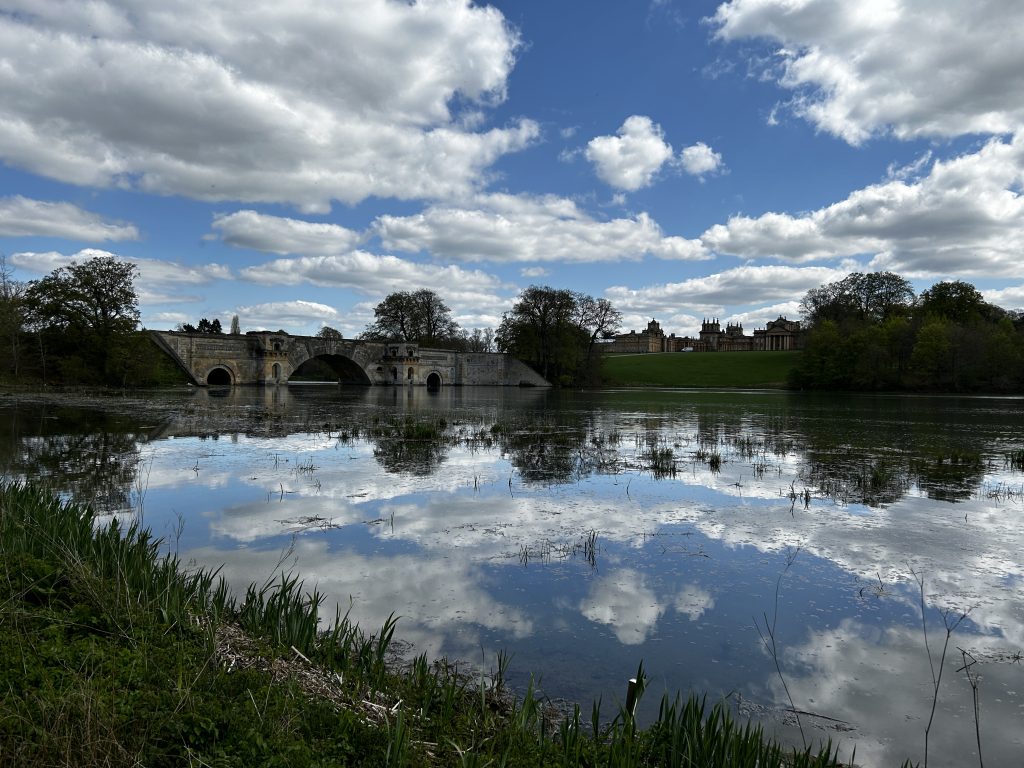
It was a sunny afternoon today, a vast change from the rain of yesterday. On the spur of the moment I decided to drive down to Woodstock and have a walk around the Blenheim Palace estate – we have annual passes so we can visit any time we like.
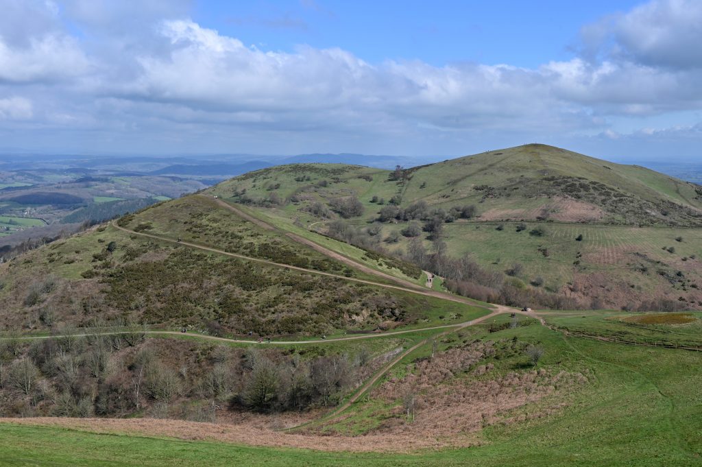
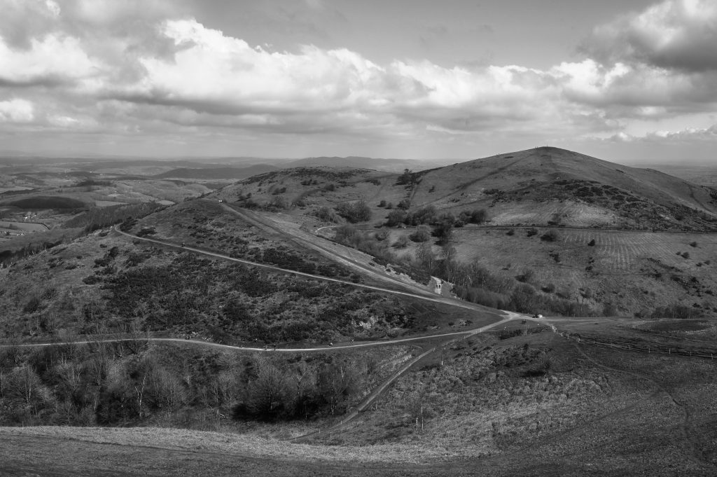
View of the Malvern Hills in Worcestershire looking towards Worcestershire Beacon and North HillView of the Malvern Hills in Worcestershire looking towards Worcestershire Beacon and North Hill – B&W Version
On 15 April I had a day out and returned to the Malvern Hills as I had not been there for some years.
This time I started by walking up to the Worcestershire Beacon and North Hill before returning to the car and moving it to another car park before climbing up to British Camp and the Herefordshire Beacon.
The black and white image was created in Tonality an app which has numerous presets for monochrome imagery.
A few years ago the Local History Group revised the walks booklet that had been on sale for a number of years. The number of walks was increased from 4 to 8 and covered the footpaths in most directions from the village.
From time to time I have been walking these routes making sure that they are still marked clearly with little or no obstructions. Sometimes I take bits of several of the walks and combine them to make it more interesting for me. Today was a case in point. The golf course was closed owing to snow so it was “Shanks Pony” for me today. I kept to the road for most of it walking from the house to Swerford before turning off for Wigginton and then returning home across the fields. The map of my route is below.
My walk on 8 March 2023 was approximately 6 miles.
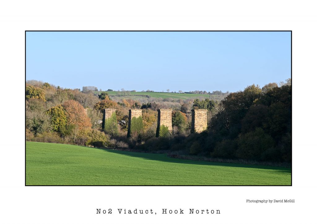
A wet day here in Hooky, so a quick edit of an image in Photoshop of No2 Viaduct taken in much better conditions last month. I used a set of print templates supplied with N-Photo magazine to highlight the subject name and my details with a black border around the image.
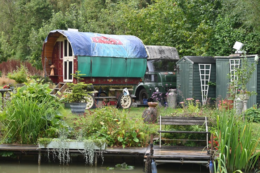
In recent months, i.e. when it has been warm and sunny I have been going out for walks exploring the local countryside. That is when I am not playing golf! My latest walk was relatively short from Cropredy along the Oxford Canal towpath to Claydon before doing a swift about turn to head back to Cropredy. Although the weather was not as good as in the past it still pays to take a camera as I found this gypsy caravan and a table for two on the bank of the canal not far north of Cropredy.
Table for two…….
Gypsy caravan and other ornaments…..
I had lunch at The Mulberry Cafe in Cropredy – only a sandwich and coffee but very tasty.
In recent weeks I have been making the most of the good weather and have embarked on some walks in the local area. The distance varies but, at present, my walks have been between 7 and 9 miles.
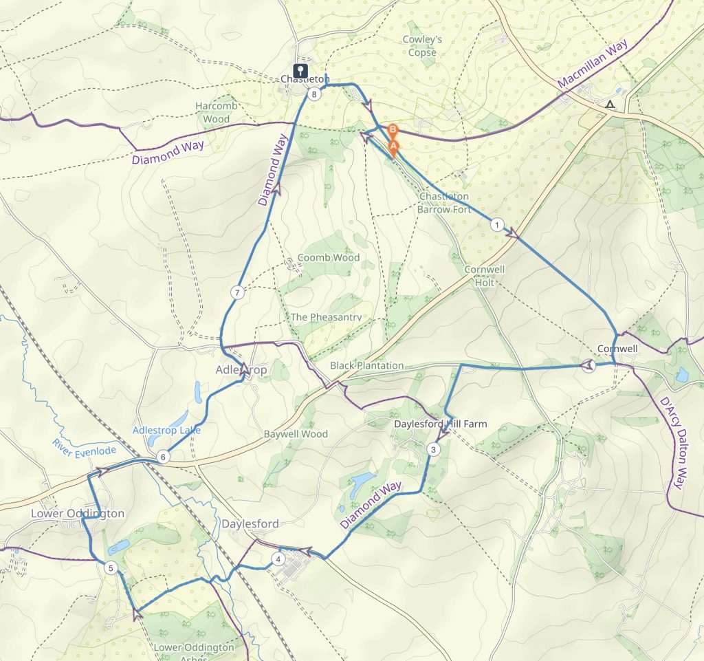
A Circular walk from Chastleton
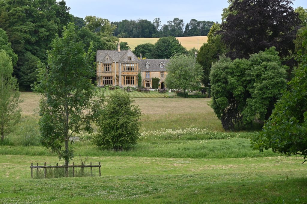
My latest was a round trip of roughly 8 miles. I parked my car near Chastleton House, a National Trust property and set off towards Cornwell then making my way to Daylesford Organic for my lunch stop. There is a bridleway which cuts through the Daylesford Estate which emerges just along the road from the farm shop. A good point for walkers is that there are several walking routes on the estate that are well signposted. Visitors are encouraged to use these footpaths, a good excuse to visit the farm shop for something to eat before going on one of the walks.
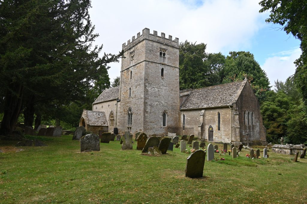
St Nicholas Church, Lower Oddington, Gloucestershire
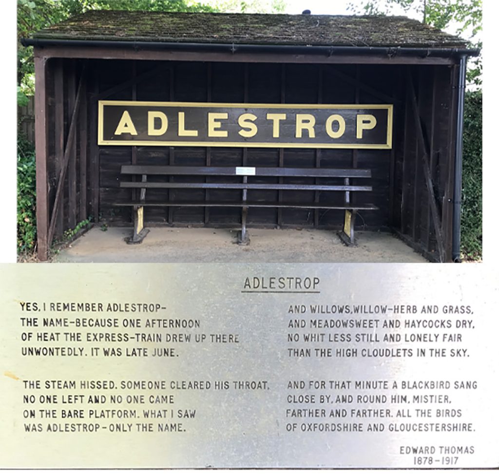
After Daylesford I walked along one of the “newly” marked footpaths to Lower Oddington before crossing the A436 to reach Adlestrop a quaint hamlet which once had a railway station.
The station sign for the long gone Adlestrop station
The railway station at Adlestrop was in existence from 1853 until 1966. All that remains is the station sign which can be found by the bus shelter.The station was immortalised by Edward Thomas in his poem following his train stopping at the station on 24 June 1914.
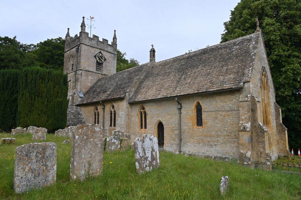
Stone corbel on the edge of a window in the parish church of St Mary Magdalene in the Gloucestershire hamlet of Adlestrop
As I walked around Adlestrop I came across this tap set into the wall of one of the houses. A small plaque informs passers by that this tap was the source of fresh water for the villagers up to the 1950s.
A disused water tap can be found by the wall of a house in the Gloucestershire hamlet of Adlestrop.
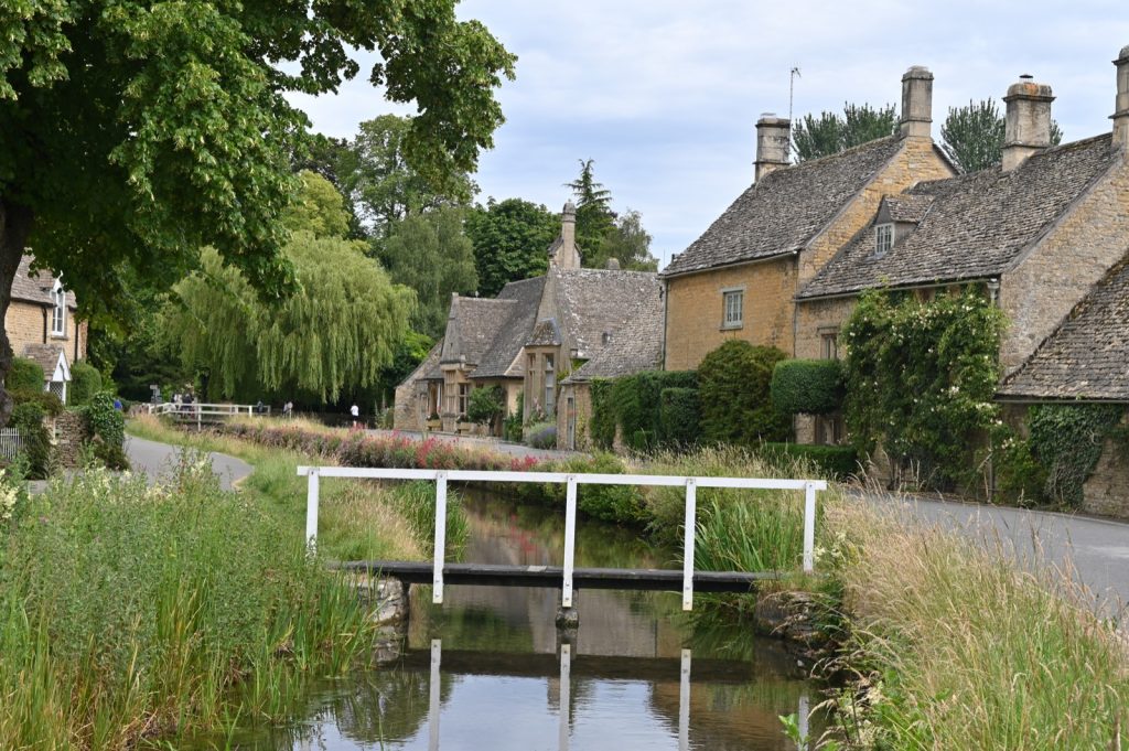
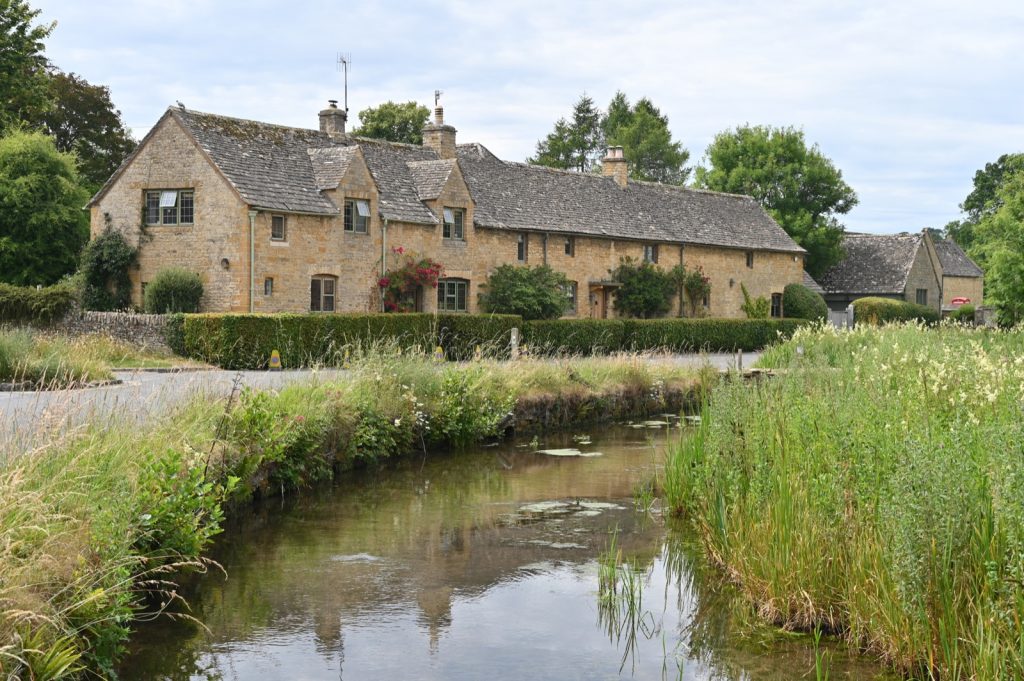
Whilst Lower Slaughter on the banks of the River Eye is perhaps more well known and photogenic its neighbour the village of Upper Slaughter about one mile up the road also has some photogenic buildings and things to see. Here is a brief gallery of 6 images taken on my recent walk there.
Lords of the Manor Hotel
St Peter’s Church
St Peter’s Church
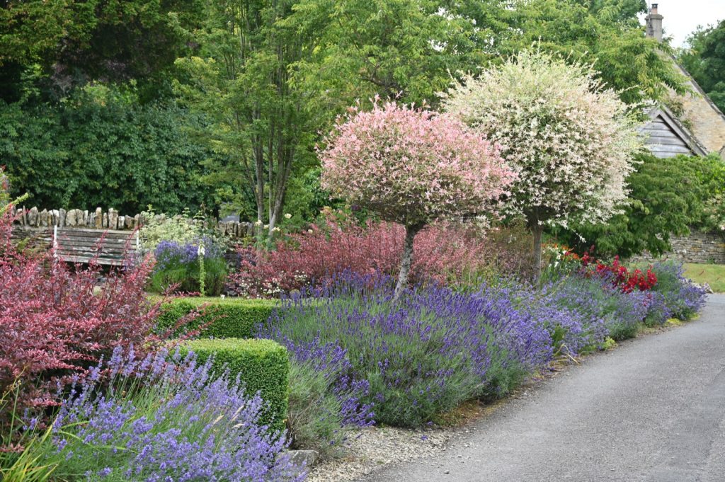
Lavender and jasmine in flower in a cottage garden
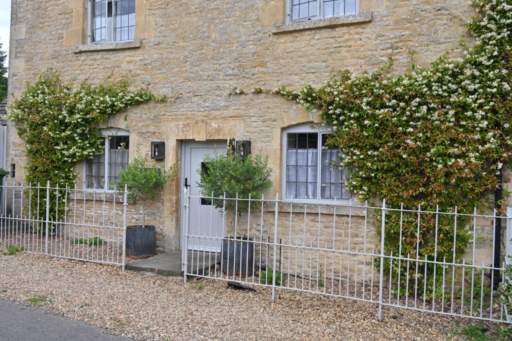
Jasmine growing on the front wall of a house
A variety of plants including sweet peas in flower
I parked my car in Lower Slaughter before that day’s tourists arrived so needless to say also took some photographs of this village too. Having left the car there I undertook about an 8 mile walk.
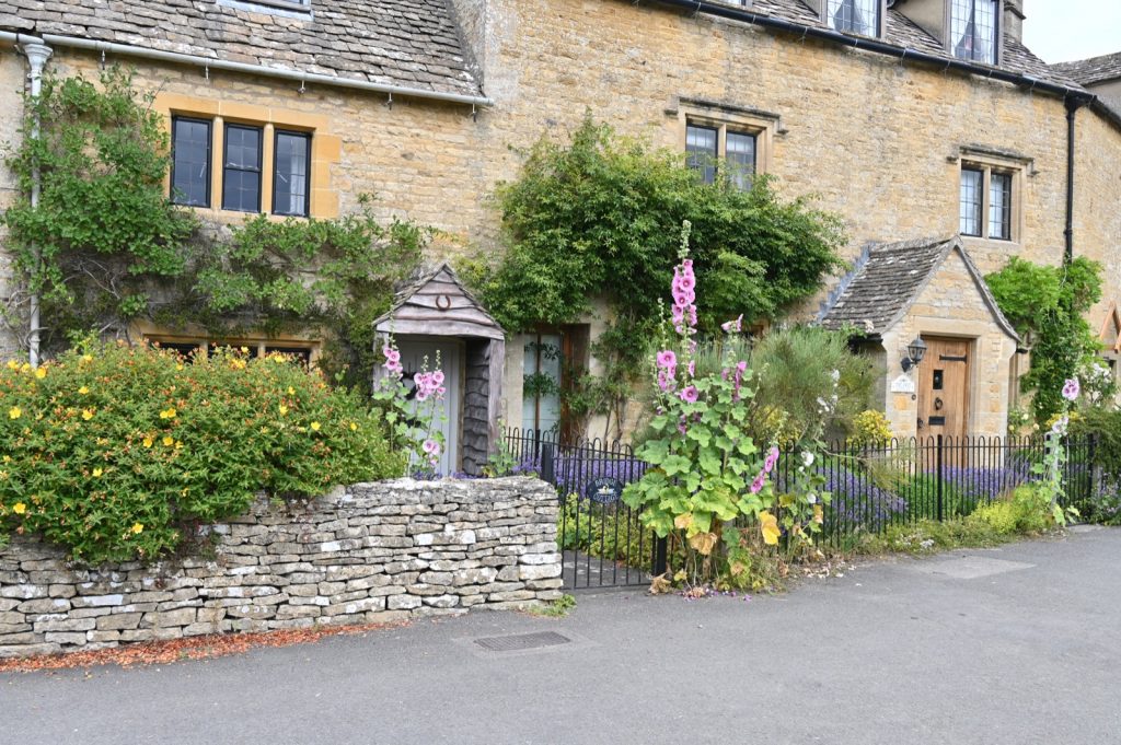
Hollyhocks in flower
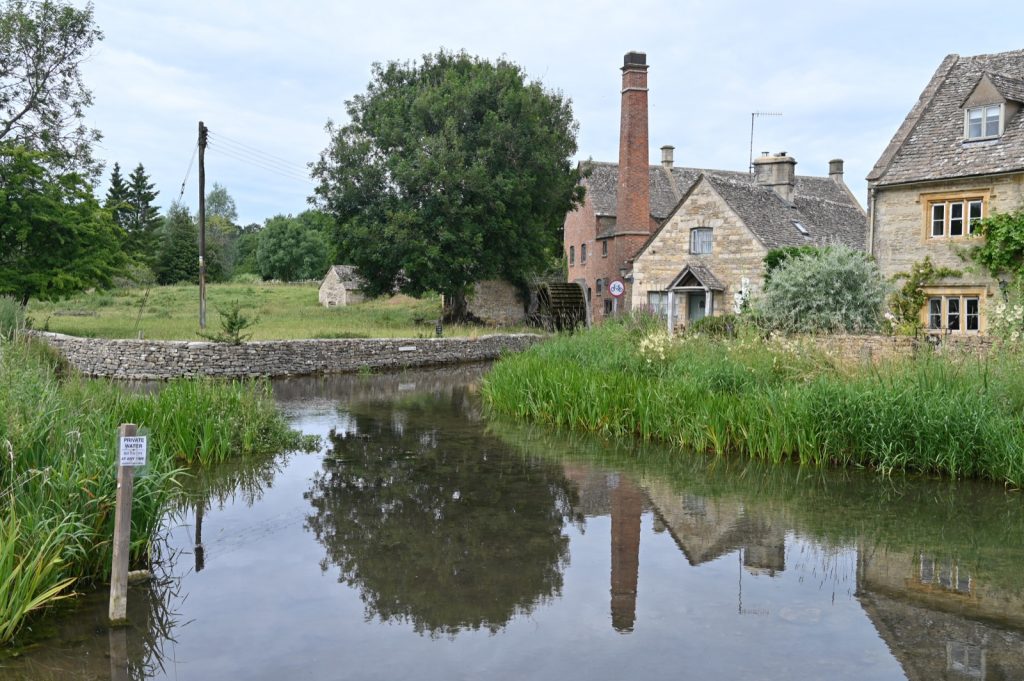
The Old Mill
The River Eye flows through the Gloucestershire village of Lower Slaughter
The River Eye flows through the Gloucestershire village of Lower Slaughter
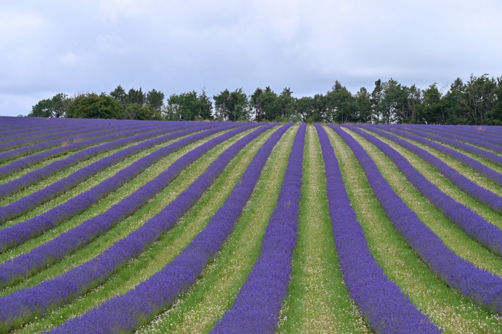
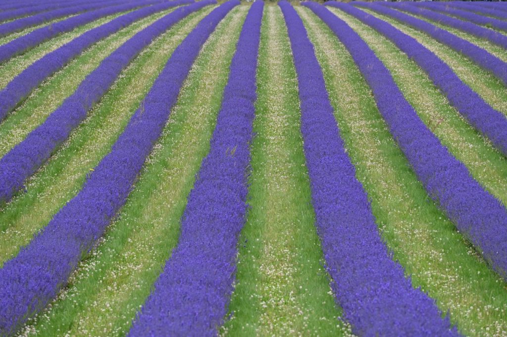
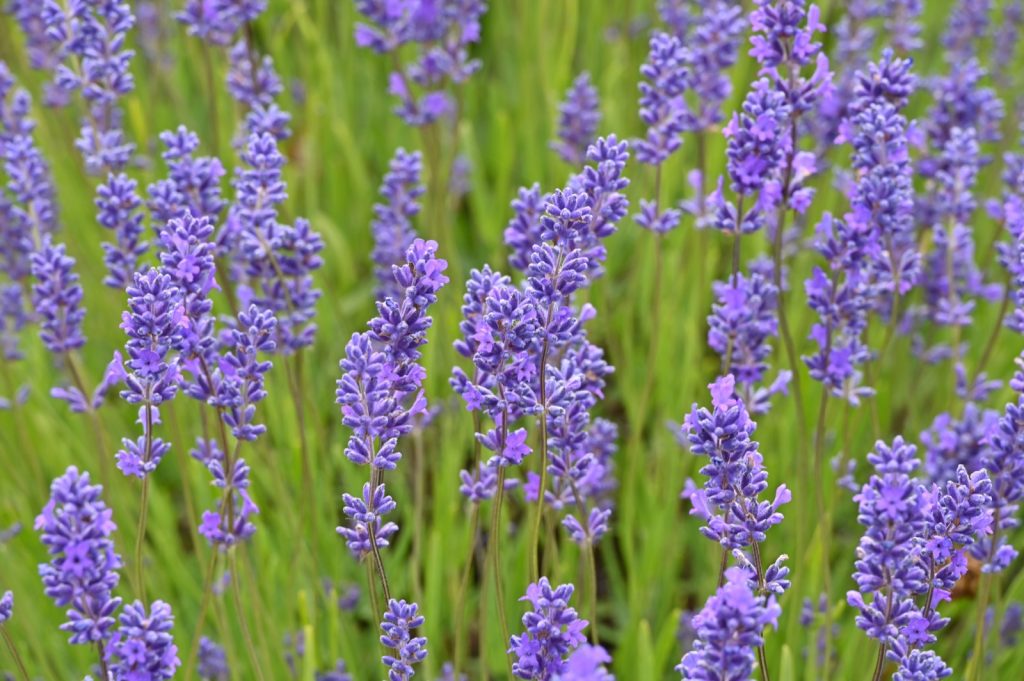
At this time of year, July/August, the lavender fields at Cotswold Lavender are in flower. They make a spectacular sight, who needs to go to Provence to see lavender in all its glory?
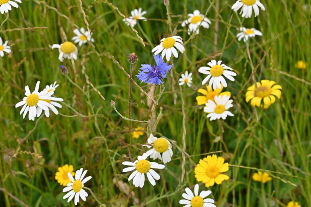
In addition to the lavender the company have also set aside an area for wildflowers to grow. They are just as photogenic as the lavender! The fields attract a lot of visitors who, armed with selfie sticks, sit down among the rows and photograph themselves. A lot of the women wear sun hats and summer dresses to contrast with the purple of the lavender. Picking and processing starts in August.
A link to the website can be found here:- https://www.cotswoldlavender.co.uk